Services
The goal of SeismicCity services group is to perform each PSDM project to the highest standards. Our Seismic Imaging services include the three technologies required for successful execution of every depth imaging project: model building, prestack depth migration and data analysis.
SeismicCity highly experienced staff uses the most advanced depth imaging technologies in the execution of depth imaging projects. These include the newest developments in depth imaging tools such as Reverse Time Migration that is based on proprietary developed recursive spatial operators, construction of detailed anisotropic models, and full wave equation simulation used in data analysis and acquisition design.
In the execution of depth imaging projects, we are using proprietary algorithms developed in-house in combination with commercial software packages. This enables us to provide the best available solutions in processing, interpretation and depth imaging.
- Accurate model building for depth imaging
- Prestack depth migration using proprietary technology
- Simulation for data analysis and acquisition design
- Anisotropic parameter estimation and model building
- Anisotropic prestack depth migration
- Interpretation and modeling of complex geological structures
- Pre-processing and data preparation for depth imaging
- Training on the practical aspects of depth imaging technology
Model building
The quality of the final depth migrated volume is only as good as the velocity / anisotropic model constructed during the model building phase. We devote the majority of the depth imaging process to building an accurate anisotropic model. Our workflow is based on repeated iterations of full volume prestack depth migration where at each iteration the model is updated using the results from the prior depth migrated volume. Every model building iteration is performed using full volume prestack depth migrated data.
GoCad/Skua technology is used for structural modeling. Using GoCad/Skua the detailed interpretations of major layer boundaries is used to construct model surfaces and combine surfaces to form geological bodies. Topology is then added to assign velocity and anisotropic fields functions to the different compartments of the model.
Velocity analysis is done using two tools: reflection tomography and prestack depth migration scans. Both are used to construct full anisotropic models. Combination of the two methods enables us to develop accurate velocity models which are used in prestack depth migration.
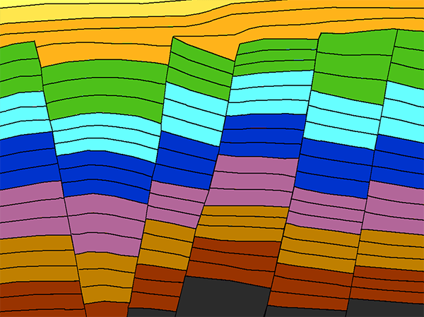
Our model building tools are suitable for construction of Gulf of Mexico (GOM) type models with smooth sedimentary velocity functions and detailed salt bodies, as well as layer based models needed for imaging of overthrust and faulted geology.
Prestack depth migration
We offer both ray based and wave based prestack depth migration (PSDM) algorithms. The ray based PSDM is a wavefront reconstruction Kirchhoff summation algorithm. The wave based PSDM is a two-way Reverse Time Migration algorithm.
The appropriate algorithm is selected based on the geological setting and the imaging objective of the project. Both wave equation based and ray trace based algorithms are used for both model building and final imaging.
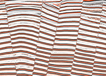
No data decimation or conditioning is applied prior to prestack depth migration. All prestack depth migrations output fully migrated volumes with image gathers output at each migrated bin.
Our prestack depth migration algorithms are implemented for any case of anisotropy. This is combined with unique workflows for the construction of anisotropic earth models.
Wave equation simulation
An integral part of depth imaging is the use of simulation to assist in understanding field acquired and depth imaged seismic data. We are offering full wave equation simulation as part of our services. Simulation is done to help in investigations of:
- Seismic illumination
- Imaging artifacts
- Acquisition design
Illumination studies
Illumination analysis is routinely done in order to interpret and identify areas of low illumination. A typical application is to investigate areas of low illumination below large salt bodies. Our illumination services are based on application of the full wave equation. No smoothing of the velocity field is done prior to simulation. The workflow for illumination analysis includes construction of a detailed model, simulation using wave equation algorithms, imaging using various depth migration algorithms and finally, extraction of illumination surfaces from the migrated volumes. The illumination surfaces are compared to amplitude maps extracted from the field data depth migrated volumes.

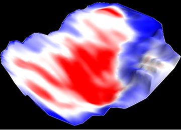
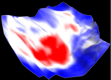
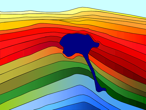
Subsalt illumination maps calculated by wave equation simulation. These illumination maps are compared to amplitude maps extracted from the field data PSDM for analysis and evaluation of a sub-salt amplitude plays.
Imaging artifacts
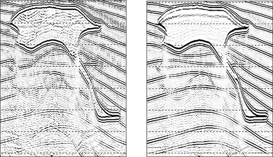
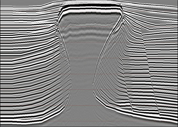
When applying prestack depth migration, the objective is to produce depth migrated volumes that include reflections from geological layer boundaries. However, prestack depth migrated volumes include coherent noise as well. Coherent noise can be a result of migrating multiples, migration operator swings in areas of low illumination or seismic data recorded along complex wave paths that were not migrated correctly. Using wave equation simulation and imaging, we are producing depth migrated data where the input model is known. With that, we can differentiate real geological reflections from noise artifacts and provide a powerful tool to assist in the interpretation of the real data.
Acquisition design
The use of 3D simulation to assist in both marine and land acquisition design has been growing in the past several years. With our 3D two-way wave equation simulation algorithms, we offer simulation based acquisition design. This service includes generation of a detailed 3D model, simulation and recording of a dataset over a large grid, and then imaging using subsets of the recorded dataset. With this workflow, key acquisition parameters can be optimized, such as cable length, azimuth distribution, number of gun and cable boats and optimal sailing directions. More than that, as part of wave equation simulation for acquisition design, a simulated dataset is generated and delivered to our clients, and can be used for testing of seismic processing technology and parameters.